Duration: 3'44''
Satellite cameras are used to track flooding and predict future weather.
Licence: ERA Licence required
UK only Staff and students of licensed education establishments only Cannot be adapted
Add Notes
Concrete and flooding | Bang Goes the Theory
Investigating the impact of concrete and paving stones on flooding.
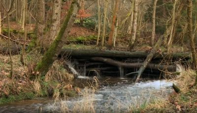
Natural flood prevention | Bang Goes the Theory
Methods of natural flood prevention that have been put in place in Pickering, North Yorkshire.
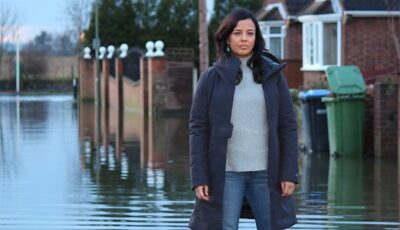
S8E6: Flooding | Bang Goes the Theory
Did global warming play a part in the recent floods, or is it the extreme end of the natural cycle? Maggie Philbin investigates the th...
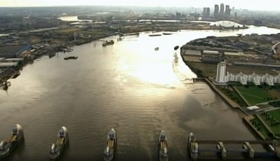
Thames Barrier | Bang Goes the Theory
How the Thames Barrier is protecting London from flooding.
What causes a storm surge? | Bang Goes the Theory
Maggie Philbin demonstrates what causes a storm surge.
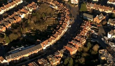
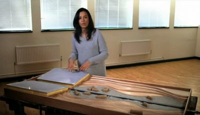
What causes flooding? | Bang Goes the Theory
A demonstration of how rainfall and changing landscapes are causing more severe flooding.
01: Frozen Worlds | Frozen Planet II
From the poles to the highest mountain peaks, there are surprising frozen worlds found on every continent, and each is home to unique an...
01: Inferno | Earth
01: London Calling | Building the Olympic Dream
This first film follows the exploits of the Ceremonies Team as they prepare to mount the eight-minute show to mark the offici...
01: Morocco | Africa Rising with Afua Hirsch
Afua explores how a younger generation of Moroccan creatives are transforming old traditions into thrilling new music, art, weav...
01: Nepal | Kate Humble: Living with Nomads
In a demanding and emotional journey, Kate Humble travels with the Raute, Nepal's very last nomadic community of just 140 hunter-...
01: The Living Forest | Landmarks
The Living Forest looks at all the animals & plants that live in the forest on the ground to the forest canopy, & shows how they live in ba...
01: Waiting for the Rains | Wonders of the Monsoon
From India to Australia, all life awaits the transforming power of the monsoon rains.
02: Deluge | Wonders of the Monsoon
From India to Thailand and Cambodia, the Asian monsoon makes its grand entrance, the bringer of life and the destroyer.
02: Frozen Ocean | Frozen Planet II
At the top of our planet lies the Arctic Ocean - a shape-shifting world of ice and water, home to unique animals like polar bears, harp s...
02: Nigeria | Africa Rising with Afua Hirsch
Afua Hirsch explores the energy and ambition of Nigerian fashion, film and music, asking what drives young Nigerians to succeed ...
02: People of the Forest | Landmarks
People of the Forest looks at the Baka of the Cameroon & the Kayapo of South America & how their lives work in balance with the rainforest.
02: Siberia | Kate Humble: Living with Nomads
Kate Humble continues her travels with the Nenets reindeer herders deep in the Siberian tundra, but plummeting temperatures jeo...
02: Snowball | Earth
02: The Last Stand at Stratford | Building the Olympic Dream
The ambition and scale of the project is huge. Resistance to the plans comes from unexpected quarters.
03: Destroying the Forest | Landmarks
By the next century, the rainforests of the world could have disappeared for ever, destroyed by outside influences and economic pressur...
03: Frozen Peaks | Frozen Planet II
A look at how mountains create unique frozen worlds, home to extraordinary animals that must overcome the crushing conditions of the cold.
03: Green | Earth
Chris Packham tells the miraculous story of how plant life turned the Earth from a barren rock into a vibrant green world.
03: Laying the Foundations | Building the Olympic Dream
With nine billion pounds to spend on creating an Olympic Park, London 2012's bosses face some big challenges.
03: Mongolia | Kate Humble: Living with Nomads
In her final journey of the series, Kate Humble travels deep into the Gobi Desert to live with an extended family of cashmere ...
03: South Africa | Africa Rising with Afua Hirsch
Afua Hirsch discovers new art, music and theatre in South Africa's townships as she explores creativity emerging in amapian...
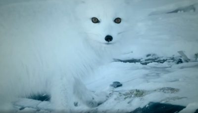
The urban Arctic fox | Snow Animals
The intrepid Arctic fox is exploiting a new world in order to survive.
How is radiotherapy kept safe? | Bang Goes the Theory
Liz Bonnin explains how cells turn cancerous by blowing high-tech bubbles.
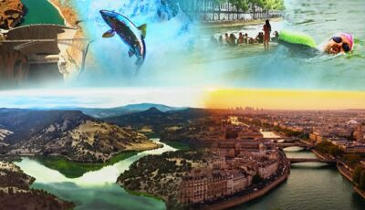
Restoring Our Rivers | Our Changing Planet
Liz Bonnin and Ade Adepitan investigate two ambitious river restoration projects: in the US, the largest dam removal in the world,...
Over land and sea | Penguins: Meet the Family
Penguins are adapted to survive and thrive both in the sea and on land.
Pig farming and water pollution | Meat: A Threat to Our Planet?
Liz Bonnin investigates the polluting impact of pig manure from factory farms.
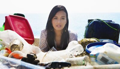
Drowning in Plastic
Wildlife biologist Liz Bonnin works with some of the world's leading marine biologists and campaigners to discover the true dangers of plastic in our oce...
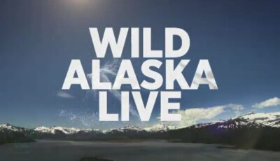
Wild Alaska Live
A new series on a spectacular wildlife event, live from Alaska with Steve Backshall, Matt Baker and Liz Bonnin. Bears, eagles and orca are gathering for the...
3: Future Frontiers | Galapagos
In the culmination of this scientific expedition, Liz Bonnin and the team see first-hand the impact that humans have had on the Galapagos Isl...
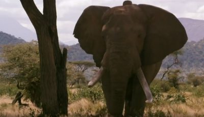
Charged by a Bull Elephant | Nature's Epic Journeys
Bob gets charged by Matt, a bull elephant.
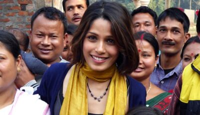
India: Nature's Wonderland
Wildlife expert Liz Bonnin, actor Freida Pinto and mountaineer Jon Gupta reveal the hidden wonders of India's surprising natural world. This is a ...
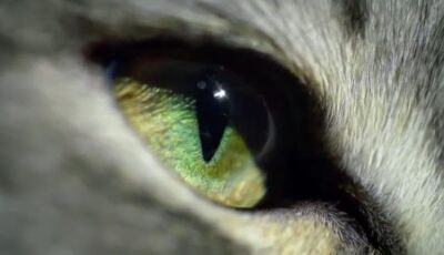
1: A Cat's Eye View | Cat Watch 2014: The New Horizon Experiment
Liz Bonnin and a team of experts conduct a groundbreaking scientific study of cats, revealing how cats exper...
Cookies help us run our services and give you a better experience. For the full details please read our Cookie Policy.